Which Emergency Beacon?
Confused by all the acronyms? Read on for a little explanation…
Global alerting and initial location
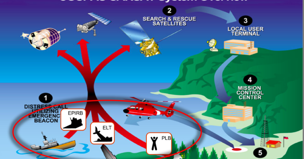
EPIRBs and PLBs transmit a 406MHz distress alert via the COSPAS-SARSAT satellite network. This provides national rescue forces with the identity and initial location of a vessel or person in imminent danger. ELTs are aircraft beacons using the same technology.
In most cases, geostationary satellites positioned over the equator will pick up the alert within a matter of minutes. However, in polar regions or where there is a poor view of the sky, other satellites come into play. A low level orbiting satellite will receive and store the message and pass it on when it is in range of a ground station. Locating the beacon can take up to 4 hours depending on satellite passes over the area.
However, a growing network of transponders on navigation satellites is starting to improve coverage, especially in high latitudes. These form the so-called MEOSAR, or Medium Earth Orbit SAR system. MEOSAR uses repeaters piggy-backed on navigation satellites operated by GPS, Gallileo and GLONASS.
GPS equipped EPIRBs or PLBs can send an accurate location with the alerting signal. In this way, the rescue forces will quickly know the initial location to within about 100 metres. For beacons without GPS, the system determines the location using the Doppler effect. This can only be done during a satellite pass over the beacon. Apart from the time delay, typical accuracy without GPS drops to 2-5 km.
Final location
A satellite alert from an emergency beacon will provide a good initial location to search for the survivors. This is quicker and more accurate for GPS beacons. However, small targets can still be very hard to find, especially in poor weather. All EPIRBs and PLBs incorporate additional transmitters operating on 121.5MHz.
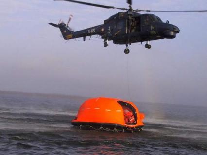
SAR helicopters and lifeboats have direction finding (DF) equipment which can home on these signals. However commercial or leisure vessels which may be quicker on-scene will not have suitable DF equipment.
EPIRBs are starting to become available that incorporate AIS SART transmissions, allowing a wide range of vessels to locate them. All EPIRBs also incorporate strobe lights to make them more visible. Most PLBs also have flashing lights for the same purpose. Additonal locating lights may be fitted to lifejackets and life rafts.
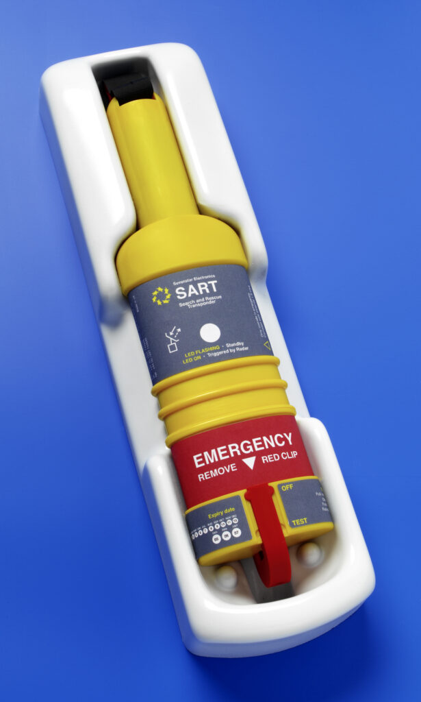
Search and Rescue Transponders (SARTs) are devices specifically designed to help in the location of survival craft. These have traditionally used radar transponder techniques to “paint” a series of dots on any X-band radar screen.
AIS SARTs are now also available. These transmit an identity and GPS location which can be picked up by most commercial vessels. An increasing number of leisure vessels also carry AIS receivers or transponders.
Man Overboard
If a crew member should fall overboard, the quickest rescue will normally be provided by their own vessel. This relies on the remaining crew being aware of the situation and able to turn the boat around and effect a rescue.
Various Man Overboard (MOB) alerting and location systems have been marketed in the past. Most of these were either of limited effectiveness or based on expensive or proprietary systems, undetectable by other craft in the area.
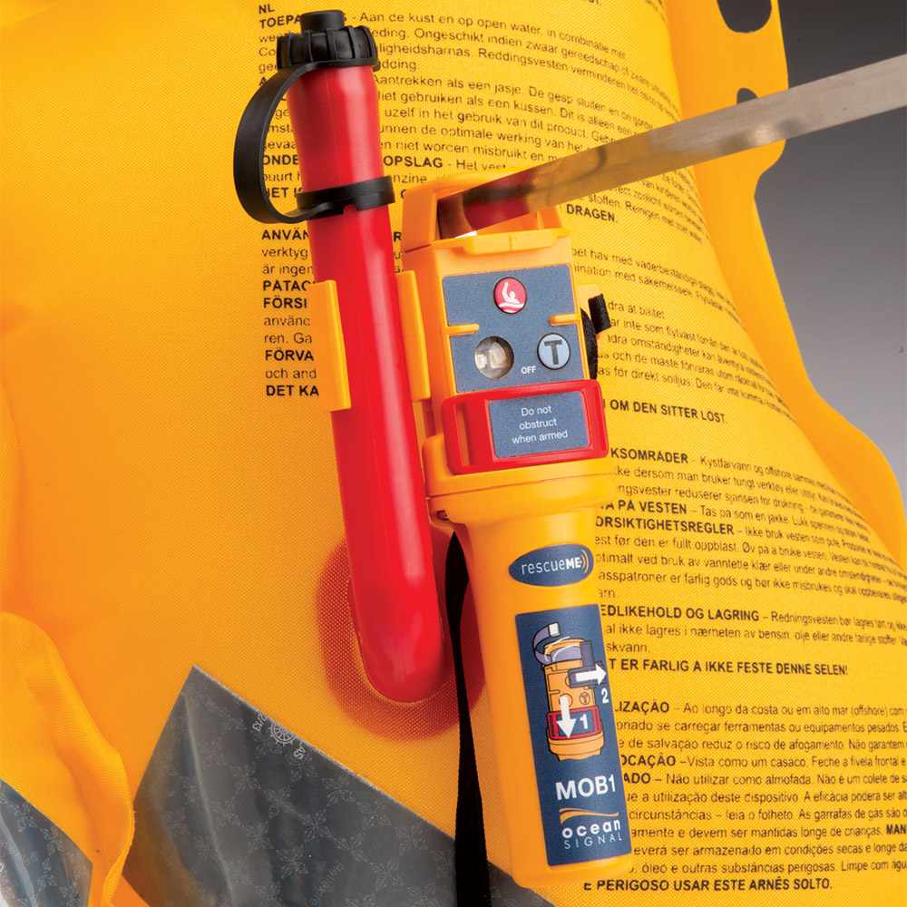
It is now possible to buy MOB beacons using the AIS SART principle, transmitting a coded signal with GPS location to all AIS receivers within range (typically 2-5nm) Ideally these should be designed to activate automatically, combined with auto inflation of a lifejacket. Some models are designed for user retro-fitting to existing automatic lifejackets.
Plotters linked to AIS receivers can trigger an alarm if one of these AIS beacons is detected. A test mode provides a way to verify correct operation and allow for crew training. It should be noted, however, that AIS is not considered a distress alerting system and it cannot be guaranteed that activation of an AIS beacon will trigger an alarm on a nearby vessel.
So, which emergency beacon is right for you? Read on…
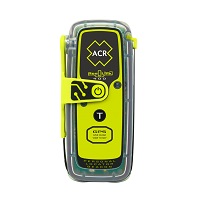
EPIRBs
Emergency Position Indicating Radio Beacons (EPIRBs) are radio distress beacons for use on all types of watercraft.
They operate world-wide using the international COSPAS-SARSAT satellite system which has provided alerts resulting in the rescue of more than 50,000 lives since its inception in 1982 up to 2019.
Early analogue beacons used the aircraft distress frequency of 121.5MHz, but these are now obsolete, and modern beacons use digital transmissions on the dedicated distress frequency of 406MHz.
All EPIRBs are approved to common standards.
Buyers can opt for EPIRBs with integrated GPS for quicker and more accurate location. The additional cost is now quite small, so if buying new or replacing an old EPIRB, it’s well worth considering. The point is well made by the Australian video below:
EPIRBs are designed to float in the water when deployed, and have seawater contacts so they will start transmitting automatically once released.
The main decision to make is whether to have a manually deployed EPIRB – which will normally be mounted in a bulkhead bracket or stowed in a grab bag – or an automatic release EPIRB which will float free and activate automatically if the vessel should sink.
Click here for answers to frequently asked questions, or contact us for help in choosing an EPIRB.
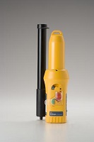
PLBs
Personal Locator Beacons (PLBs) are emergency beacons which operate through the same satellite network as EPIRBs, but are designed to be small enough to fit a pocket or even lifejacket.
However they have a shorter operating time, and must be manually activated and held out of the water with a continuous and clear view of the sky.
The big advantage of a PLB is that it can be kept close at hand in case of an emergency. Sometimes an EPIRB may be unreachable in case of a sudden capsize, or fire in the cabin, for instance.
For man overboard use, it should be borne in mind that PLBs are not permitted to be automatically activated, and their transmissions are aimed at the world-wide rescue system and unlikely to be detectable by commercial or leisure vessels.
Click here for answers to frequently asked questions, or contact us for help in choosing a PLB.
SARTs
Search and Rescue Transponders (SARTs) are short range locating devices, operating either on radar or AIS. All international passenger and cargo vessels carry SARTs for location of survival craft.
SARTs allow vessels which happen to be in the area of a distress incident to look for survival craft, using their radar or AIS equipment. These vessels do not have the specialist direction finding equipment carried by SAR (Search and Rescue) assets such as lifeboats and helicopters.
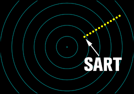
Radar SARTs produce a series of dots on nearby radar screens, providing a range and bearing to the liferaft.
Typical detection range for a SART of either type at sea level is 5-10 miles.
AIS SARTs operate over a similar range (up to 10nm depending on the height of the search vessel’s antennas), but will show up on the chart plotter as a special symbol, and may trigger an alarm, depending on the plotter software and settings.
You may also like to look at our Frequently Asked Questions page.
When you are ready to look at specific models, please visit our online shop.